Ancient World Maps
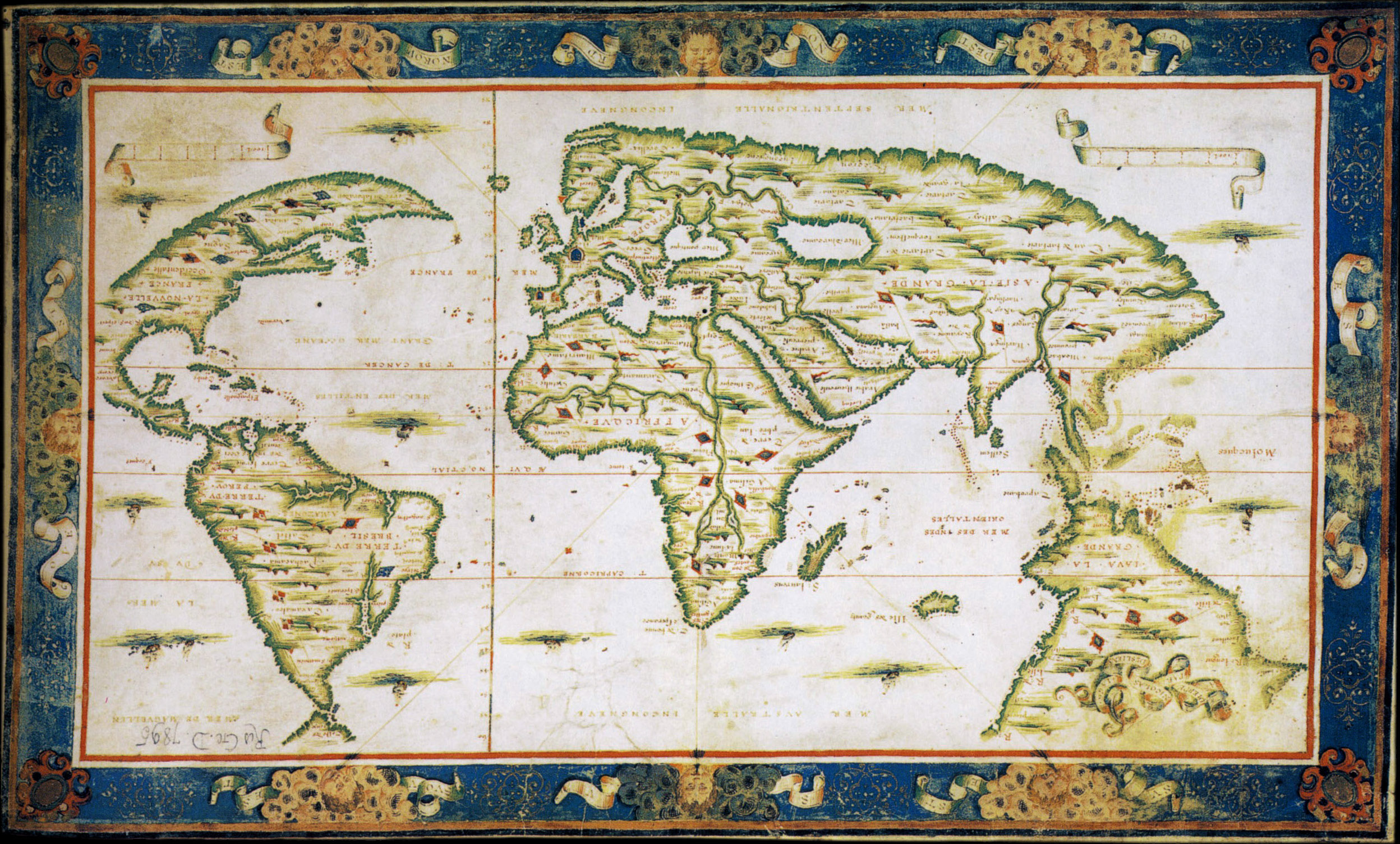
16:14Have you ever wondered how our world was before the great volcano eruptions on 15th-16th century that changed the whole world's map? I found some that caught my interest the most: the ones that showed that the world was shaped differently than it is now; North America wasn't as big as it is now and Canada (the almost crescent shape at the left side) was connected to Brazil (South America); Australia was connected to South America and Java was a continent of its own.
Dieppe (Dauphin) Maps
According to wikipedia:
The Dieppe maps are a series of world maps produced in Dieppe, France, in the 1540s, 1550s and 1560s. They are large hand-produced maps, commissioned for wealthy and royal patrons, including Henry II of France and Henry VIII of England. The Dieppe school of cartographers included Pierre Desceliers, Johne Rotz, Guillaume Le Testu, Guillaume Brouscon and Nicolas Desliens.
Let's check on these following Dieppe maps:
 |
| Guillaume Brouscon's 1543 Dieppe Map |
Above, we can see this as the oldest world map we have in archive. Australia looks like an expansion of South America (left below) and North America (look at the flag above South America) was narrow and bending. Canada was very big to the north-most and most of its part was unidentified yet. Most of East Europe (Asia) was also unidentified, as also the Terre Ostrale.
 |
| Guillaume Le Testu's 1556 Dieppe Map |
In the map above we can see the shape of South America was slimmer than before and the unidentified lands were already taken shape. The Terre Ostrale has Grande Iave and Terre Australle at the south of it. This means, there was already a catastrophic disaster that caused these changes, but not too big. We can also see that most of the world was covered with lands instead with seas/oceans.
.jpg) |
| Nicolas Desliens's 1566 World Map |
In the map above we can see that most of the lands had disappeared at the north-most but the shape of America & Canada was still sickle-like and Borneo, Sulawesi and Papua (of Indonesia) wasn't as big as it is now today. There should be another volcano eruptions that caused these land shifts.
Jave le Grande
The more I research on this, the more evidence I found that most of the cartographers focusing on Iava la Grande or Jave la Grande. It is believed that this ancient Java was the disappearing Atlantis, although most of people thought it was Australia. If we look at the maps, they show some differences of the maps from 1543 to 1566. There must be some missing evidence and details about what happened at this time, but the only explanation is some catastrophic disasters must happened.
According to wikipedia:
La grande isle de Java (“The great island of Java”) was, according to Marco Polo, the largest island in the world: his Java Minor was the actual island of Sumatra, which takes its name from the city of Samudera (now Lhokseumawe) situated on its northern coast.
Robert J. King has suggested that Alfonse’s description of La Grande Jave could also fit the Regio Patalis promontory on Oronce Fine’s world map, and indicates that the Dieppe Maps appear to have conflated Marco Polo’s Greater Java with Fine’s Regio Patalis and Brasielie Regio.[18] On the Dieppe Maps, the great promontory of JAVE LA GRANDE (Greater Java) extends, like the Regio Patalis, northward from the Austral continent. The evolution of Fine’s REGIO PATALIS into JAVE LA GRANDE may have been influenced by the phrase used by Ludovico di Varthema, an Italian from Bologna who made a voyage in 1505 from Borneo to Java, who said that Java, “prope in inmensum patet (extends almost beyond measure)”.
 |
| The Dauphin Map 1530 and 1628 |
In the maps above we can clearly see the changes of what it was before Indonesia (it was called Nuswantara), from Samatra (Sumatra) to Java La Grande (Atlantis--it wasn't really Atlantis but Atlantis was a part of Java La Grande and it's not Australia at all--I will explain this another time) in 1530 and 1628. Again, there must be some catastrophic disasters (such as volcano eruption) that made the world map changed several times during that century.
(Actually I have another theory about this, but let's save it for later post.. or to be written in my novels!)
Volcanoes
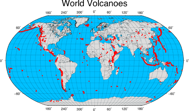 |
| Ring of Fire - via geospatialdesktop |
The list of volcanoes eruption during that time was: Pinatubo, Luzon, Philippines (1450); Nemrut, Turkey (1441, 1597, 1692); El Teide, Tenerife, Europe (1492); Chaparrastique/San Miguel, El Savador, Central America (1510-1515); Galeras, Colombia, South America (1535, 1580, 1616); Kelud, Java, Indonesia (1586, that took out more than 10,000 lives); Cotopaxi, Ecuador, South America (16th century); Villaricca, Chile, South America (16th century); Merapi, Java, Indonesia (16th century); Gamalama, Ternate, Indonesia (16th century) and many others.
The map of 1628 was already shaping most of the islands of Indonesia as it is now, but the part that they call as Land of the South would be changing again during a closing of several of Nuswantara kingdoms. Since 2010, there are hundreds of natural disasters happened such as tsunami, hurricane, tornadoes, earthquakes, landslides, floods and volcanoes erupting--most of the volcanoes are located in Indonesia.
The recently active Indonesian volcanoes are Merapi (Central Java), Kelud (East Java), Sinabung (North Sumatra), Slamet (Central Java), Semeru (East Java) Marapi (West Sumatra), Lokon (North Sulawesi), Anak Krakatau (West Java), Barujari (Anak Samalas-NTB), Gamalama (Ternate), Karangetang/Api Siau (North Sulawesi), Soputan (North Sulawesi), Dukono (North Maluku/Halmahera), Rokatenda (Palue, NTT).
What do you think? Would there be another change in world map soon?



0 comments