Anyway, here's the latest video pitch for Tosan Aji The Movie.. If you are interested on joining us in producing or as a team in the production, let me know!
Click here for more details or send me email for the proposal.


 |
| free books from national library |
 |
| Meita, me, Maria, Christin, Albeta and little Freya |
 |
| www.pnri.go.id |
 |
| Arie, Alvin, Robby, Hendra, Arief, Beatrix, (Melissa & Dewi), Yune, me, Delta and Ernest |


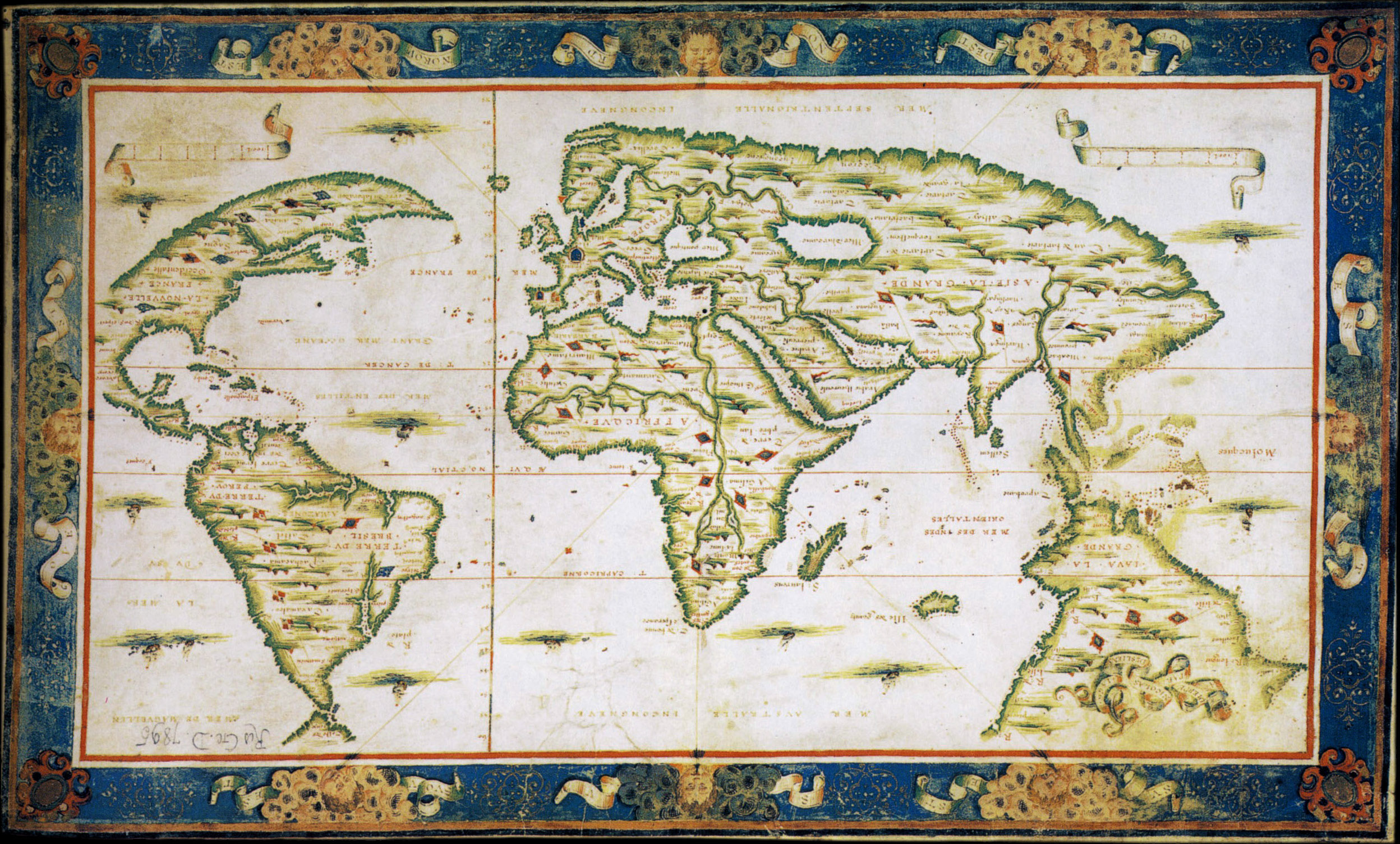
The Dieppe maps are a series of world maps produced in Dieppe, France, in the 1540s, 1550s and 1560s. They are large hand-produced maps, commissioned for wealthy and royal patrons, including Henry II of France and Henry VIII of England. The Dieppe school of cartographers included Pierre Desceliers, Johne Rotz, Guillaume Le Testu, Guillaume Brouscon and Nicolas Desliens.
 |
| Guillaume Brouscon's 1543 Dieppe Map |
 |
| Guillaume Le Testu's 1556 Dieppe Map |
.jpg) |
| Nicolas Desliens's 1566 World Map |
La grande isle de Java (“The great island of Java”) was, according to Marco Polo, the largest island in the world: his Java Minor was the actual island of Sumatra, which takes its name from the city of Samudera (now Lhokseumawe) situated on its northern coast.
Robert J. King has suggested that Alfonse’s description of La Grande Jave could also fit the Regio Patalis promontory on Oronce Fine’s world map, and indicates that the Dieppe Maps appear to have conflated Marco Polo’s Greater Java with Fine’s Regio Patalis and Brasielie Regio.[18] On the Dieppe Maps, the great promontory of JAVE LA GRANDE (Greater Java) extends, like the Regio Patalis, northward from the Austral continent. The evolution of Fine’s REGIO PATALIS into JAVE LA GRANDE may have been influenced by the phrase used by Ludovico di Varthema, an Italian from Bologna who made a voyage in 1505 from Borneo to Java, who said that Java, “prope in inmensum patet (extends almost beyond measure)”.
 |
| The Dauphin Map 1530 and 1628 |
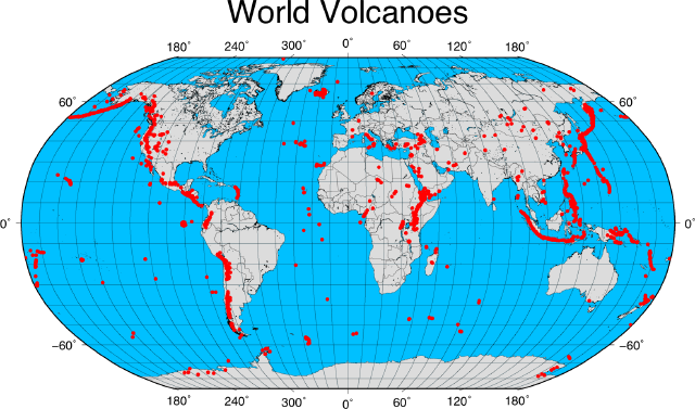 |
| Ring of Fire - via geospatialdesktop |

.jpg)
.jpg)
.jpg)
.jpg)
.jpg)
.jpg)
.jpg)
.jpg)
.jpg)
.jpg)
.jpg)
.jpg)
.jpg)
.jpg)
.jpg)
.jpg)
.jpg)
.jpg)
.jpg)
.jpg)
.jpg)
.jpg)
.jpg)
.png)


